How GIS Powers Modern Astronomy

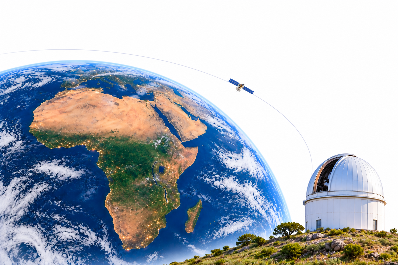
Space Situational Awareness (SSA) is the ongoing work of detecting, tracking, and predicting objects and natural hazards in Earth’s orbital environment. Modern economies rely heavily on satellites for mobile banking, navigation, weather forecasting, and daily communication. Protecting that orbital infrastructure requires keeping a constant, accurate watch on the space around our planet, and astronomy sits at the very heart of this effort.
To monitor this environment, scientists deploy both space-based sensors and ground-based observatories. Here on Earth, different ground-based instruments perform distinct, vital roles. Optical telescopes track active satellites and fast-moving space debris as they cross the sky, helping operators avoid collisions. Solar telescopes monitor the Sun’s surface and atmosphere to warn us of solar flares and coronal mass ejections that can disrupt power grids and satellite electronics. Meanwhile, radio instruments listen to the broader space environment and solar radio bursts that interfere with communication and navigation signals. Yet, while considerable effort goes into designing and funding these sensitive machines, far less public thought goes into a foundational question: where on Earth should they stand?
The Hidden Cost of Convenience
Every ground-based instrument needs a physical home, and choosing that home starts with understanding what these sensitive machines actually require to see and hear the sky. For an astronomical site to perform well, the environment above and around it must stay quiet and clear. Optical telescopes require dark skies free from artificial glare, dry air with minimal cloud cover, and steady atmospheric winds so that images of distant satellites do not blur. Radio instruments, on the other hand, depend on electromagnetic silence; they must be shielded from stray human radio signals, generated by mobile phone towers, power lines, and broadcast transmitters, that easily overwhelm faint signals coming from space. At the same time, every observatory still needs practical human infrastructure, including reliable electricity, road access for maintenance, and high-speed internet to send large volumes of data to researchers.
This creates a fundamental conflict, and it is where many African space projects quietly struggle. The land that offers reliable grid power, paved roads, and fibre internet is almost always land already heavily shaped by human activity, flooded with city lights, crowded with mobile towers, and often sitting in humid, low-lying areas near major population centers. Meanwhile, the dry, elevated, radio-quiet landscapes that offer the clearest view of the cosmos are usually remote and difficult to evaluate. Because physically travelling across vast territories to measure sky darkness, atmospheric moisture, and radio noise takes years and drains limited budgets, project teams often fall back on land that is simply accessible or already owned by an institution. When convenience dictates location over environmental suitability, the scientific instrument pays for that compromise for decades through blinded optical sensors, drowned-out radio signals, and lost observation nights.
Turning a Map into a Decision Engine
Making a sound siting decision requires evaluating an entire country systematically, comparing thousands of potential locations against both environmental conditions and engineering trade-offs before committing time or money on the ground. A tool capable of doing that large-scale spatial evaluation already exists, though it is rarely associated with astronomy especially in Africa. Across Africa, Geographic Information Systems (GIS) are overwhelmingly linked to Earth-bound work such as mapping agricultural yields, managing county land registries, tracking forest cover, and planning urban infrastructure. Because astronomical instrumentation is still growing in the region, few people connect geospatial mapping software to looking outward into deep space.
Yet choosing where to place an observatory is fundamentally a spatial evaluation problem, and GIS is built to compare multiple variables across large landscapes at once. Through a structured analytical method called Multi-Criteria Decision Analysis, GIS allows planners to stack dozens of digital data layers onto a single geographic map. Instead of relying on guesswork or launching expensive physical expeditions from day one, researchers can assess how every region performs across all criteria simultaneously, identifying which sites offer the best balance of sky quality, terrain protection, and realistic infrastructure access.
Translating Sky Requirements into Map Layers
For an astronomical observatory, abstract scientific needs translate directly into measurable geographic layers. To measure light pollution, planners use satellite nighttime light maps to see where artificial glow will wash out faint satellites and stars. To prevent Radio Frequency Interference (RFI), the stray human signals from mobile masts, power lines, and broadcast stations that can overwhelm a sensitive radio receiver, GIS maps population density, telecom infrastructure, and major highways to locate radio-quiet zones.
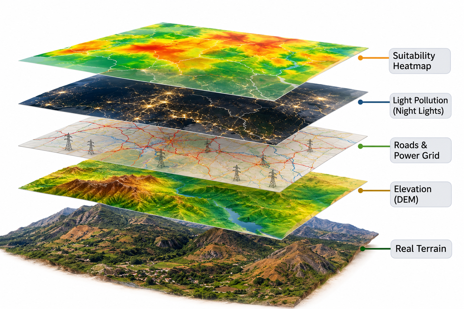
Beyond human interference, the atmosphere and the shape of the land itself must be mapped. Historical satellite climate records reveal cloud cover, rainfall, wind speeds, and atmospheric water vapour, which is critical because moisture in the air absorbs faint radio waves and blurs optical images. Planners also feed Digital Elevation Models (DEMs) into the GIS to evaluate altitude, terrain shape, and line-of-sight clearance. For optical telescopes, higher elevation places the instrument above the thickest, most turbulent, and moisture-heavy layers of the lower atmosphere while ensuring an unobstructed horizon free from surrounding hills or tall structures, delivering a sharper, wider view of the sky as satellites pass overhead. For radio astronomy, terrain models serve the opposite purpose: placing a dish inside a natural valley or behind a mountain range uses the surrounding hills as a physical shield against distant radio transmitters. Finally, engineers overlay existing roads, electrical grids, and fibre-optic cables to calculate how far a site sits from essential utilities and whether connecting it fits the project budget. In the GIS workflow, each layer is scored and assigned a mathematical weight tailored to the specific instrument, a radio dish prioritises radio silence above all else, while an optical debris-tracker prioritises high-altitude, dark, cloud-free skies, until the strongest candidate locations stand out clearly on the map.
Navigating the Challenge of Proxy Data
The honest technical difficulty in this process is that very little geographic data was ever collected with astronomy in mind. Researchers cannot simply log into a standard GIS database and download a neat, ready-made layer labeled "sky darkness" or "radio quietness." Instead, scientists must work creatively with proxy datasets, existing environmental and infrastructure records that stand in as reliable indicators for astronomical conditions.
Nighttime light mapping is the clearest example of both the power and the limits of these proxies. Because we do not have ground-based sky quality meters installed across every square kilometer of Earth, astronomers rely on satellite sensors, most notably the VIIRS Day/Night Band aboard the Suomi NPP and NOAA satellites, which underpins global models like the World Atlas of Artificial Night Sky Brightness, to estimate optical sky darkness from orbit. Yet this remains strictly a proxy because a satellite and a telescope measure two different physical phenomena. While an orbiting sensor captures upward radiance escaping directly into space from streetlights and buildings below, a ground-based telescope experiences downward skyglow, light from cities up to two hundred kilometers away that scatters off dust, aerosols, and water molecules in the atmosphere and bounces back toward the ground. Modern blue-rich LED streetlights make this gap even more noticeable, as they emit short blue wavelengths that scatter heavily across the night sky even though the satellite sensor itself is blind to blue light below 500 nanometers.
In practice, this means planners cannot simply pick a dark patch of land right next to a bright city; using GIS, they must model how far a city’s light dome spills across the surrounding landscape, and then verify the true sky darkness on the ground.
Alongside nighttime satellite imagery, meteorological reanalysis models provide estimates of precipitable water vapour high in the atmosphere, while open-source telecom registries and census population grids act as proxies for radio noise. Because all of these datasets are built in standard geospatial formats, they can be loaded, combined, and analysed using readily available GIS software, including free, open-source platforms as well as commercial tools, without needing specialised astronomical programs. Working with these proxy layers in standard GIS tools allows a small team to screen an entire country in a matter of days rather than years. At the same time, the physical limits of proxy data explain why the digital map never replaces fieldwork or eliminates on-the-ground testing. Rather, it narrows down millions of square kilometers to a handful of top candidate sites, telling engineers exactly where expensive, time-consuming field measurements, with real sky meters and radio receivers, are truly worth doing.
Scaling the Logic Across Africa
The most famous example of this systematic spatial thinking at scale is the Square Kilometre Array (SKA). When selecting a host between Western Australia and South Africa’s Karoo region, planners evaluated strict geographic and environmental criteria, including baseline radio interference, the long-term sustainability of a radio-quiet zone, physical terrain, data connectivity, and operating costs. Once mapping and modeling narrowed the options, engineering teams drove to the top remote sites to measure radio noise directly with specialised equipment, ultimately leading South Africa to protect the region in law through the Astronomy Geographic Advantage Act of 2007.
A project does not need the massive budget or scale of the SKA to apply this exact same logic. A single optical camera tracking orbital debris, a solar radio spectrometer monitoring space weather, or a Global Navigation Satellite System (GNSS) station supporting either space weather research or precision navigation benefits from rigorous spatial screening before a single bag of concrete is poured. As Africa works to deploy more ground-based instruments to advance global space science and protect vital satellite services, the best time to ask where is before construction begins. Using mapping tools and environmental datasets already within reach, GIS offers a clear, scientific way to decide where Africa looks at the sky.